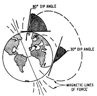
Figure 4-20.-Dip angles.
are known as angles of dip (fig. 4-20). At any given
point between the equator and the magnetic poles, the
relationship of the angle between the earth’s surface
and the magnetic lines of force is between 0° and 90°.
This angle is determined by drawing an imaginary
line tangent to the earth’s surface and to the line of
force where it enters the earth’s surface. The angle
thus formed is called the DIP ANGLE.
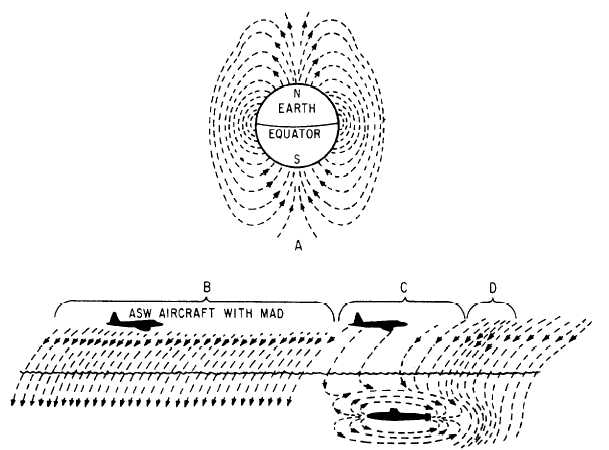
If the same lines are traced only a short distance,
300 feet for instance, their natural changes in
variation and dip over such a short distance
(short-trace) are almost impossible to measure.
However, short-trace variation and dip in the area of a
large mass of ferrous material, though still extremely
minute, are measurable with a sensitive anomaly
detector. This is shown in figure 4-21. The dashed
lines represent lines of force in the earth’s magnetic
field.
View A shows the angular direction at which
natural lines of magnetic force enter and leave the
surface of the earth. Note that the angles of dip are
considerably steeper in extreme northern and
southern latitudes than they are near the equator.
View B represents an area of undisturbed natural
Figure 4-21.-Simplified comparison of natural field density and submarine anomaly.
4-16