
Facts about Earth
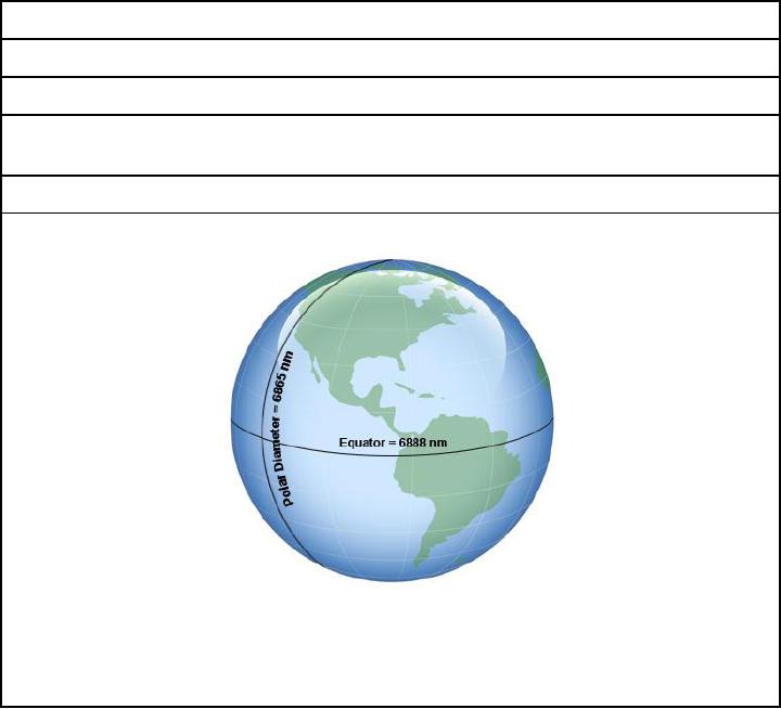
Earth is not a perfect sphere.
The diameter at the equator equals approximately 6,888 nautical miles (nm).
The polar diameter is approximately 6,865 nm, or 23 miles less than the diameter at the
equator.
Technically, earth is shaped like an oblate spheroid (a sphere flattened at the poles).
For the purposes of navigation, we assume that we are working with a perfect sphere.
The difference between the two diameters is small enough to be considered
insignificant. Nautical charts do NOT take earth's oblateness into account.
Table 2-1 -- Facts about the Earth
Reference Lines on Earth
The location of any point on earth may be defined by using a system of geographic
coordinates (grid) much like you would use a state or city map.
Geographic Coordinates
Table 2-2 contains explanations and definitions used in determining position on earth s
―grid.‖ It should help you understand how position can be determined for any place on
earth.
2-3