
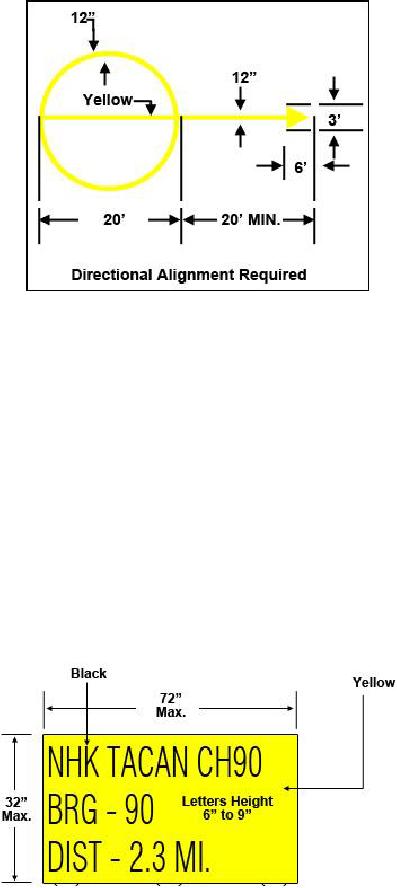
Figure 4-4 -- Tactical Air Navigation (TACAN) checkpoint marking.
TACAN Checkpoint Sign
TACAN checkpoint signs are used in conjunction with TACAN checkpoint markings.
The pilot uses the information that the checkpoint sign provides when verifying the
operation of a Navigational Aid (NAVAID) in the aircraft before takeoff. The sign is
placed at least 25 feet from the edge of the taxiway and not less than 200 feet from the
runway edge. The sign is normally located on the same side of the taxiway as the turn
onto the runway. The sign informs the pilot of the identification code and type of
NAVAID, radio channel, magnetic bearing, and the distance in nautical miles to the
transmitting antenna from the checkpoint. The sign has black characters on a yellow
background (see Figure 4-5).
Figure 4-5 -- TACAN checkpoint sign.
4-12